
Severn estuary from Gloucester to Sharpness
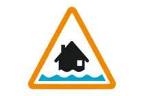
Flood Alert
Severn estuary from Gloucester to Sharpness
High tides tomorrow morning may lead to flooding.
Flooding is possible from 8am to 10am on 27/10/2026.
Tidal flooding may affect low lying land and roads adjacent to the Estuary from Sandhurst to Chepstow and Sharpness over the next 3 days. Some lengths of the flood embankment at Longney and The Noards may be overtopped. Rodley Lane, Westbury and Awre Road, Brims Pill may be flooded. Predicted peaks: Sandhurst 3.3m to 3.5mm on 27/10 09:45AM, Gloucester 3.3m to 3.5m on 27/10 09:30AM. Sandhurst 3.3m to 3.6m on 27/10 22:00PM, Gloucester 3.3m to 3.5m on 27/10 22:00PM. Tidal peak impacts are not forecast to affect other gauging points.
We are closely monitoring the situation .
Avoid coastal roads and low lying roads near rivers, which may be flooded.
This message will be updated by 11:00AM on Tuesday 27 October or as the situation changes.
Text as issued by The Environment Agency
Last updated at: 12:22 Oct 26
Further Local Information
Nearby Flood Warnings
None
Nearby Alert Areas
Local Stations
No nearby stations
FloodMapper is an independent site and is not associated with any government bodies (e.g. Environment Agency).
Copyright © FloodMapper 2023-2025.
All Rights Reserved