
Coast from Ramsgate to Kingsdown
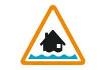
Flood Alert
Coast from Ramsgate to Kingsdown
High tides tomorrow morning may lead to flooding.
Flooding is possible from 09:45 to 13:45 on 28/10/2026.
Locations most affected will be coastal roads and footpaths. The high tide for Dover at 11:45 on Wednesday 28th October is expected to reach a height of 3.74m above ordnance datum. Winds will be Force 4 Westerly and waves are expected to reach 1.2m in height. The high tide height consists of a surge of around 0.47m on top of astronomical tide heights. Beyond this tide conditions are expected to improve and further alerts are not expected at this time.
We are closely monitoring the situation .
Avoid coastal roads, footpaths and carparks, which may be flooded.
This message will be updated by 5:00PM on Wednesday 28 October or as the situation changes.
Text as issued by The Environment Agency
Last updated at: 16:31 Oct 27
Further Local Information
FloodMapper is an independent site and is not associated with any government bodies (e.g. Environment Agency).
Copyright © FloodMapper 2023-2025.
All Rights Reserved